Data Management
Can Your Applications Find You?
Actian Corporation
August 8, 2017

One important trend in database management is integrating location data better to improve insights about events and activities that matter to your business.
…Interest in analyzing geospatial/location data has increased over the past four years from 26% to 36%.”
Source: Gartner Survey Analysis: Big Data Investments
Begin Tapering in 2016, September 2016
Tracking customer location can be critical for offering location-based services, particularly for travelers (think Uber matching cars to riders, or restaurants making offers to customers nearby) and for shoppers (to optimize shelf locations for popular items and perhaps make real-time offers). Tracking and managing assets by location can not only improve response time to failures but track potential interactions that ultimately predict future failures.
Actian Ingres has supported geospatial data for a few years now, recognizing location as a data type to improve the validity, accuracy, and processing of location data. Earlier this year, we extended that support in Ingres and Actian X by introducing a plugin for ESRI ArcGIS 10.x users to view and manipulate geospatial data. ArcGIS, ESRI’s geographic information system (GIS) for working with maps and geographic information, is used for creating and using maps and mapping information.
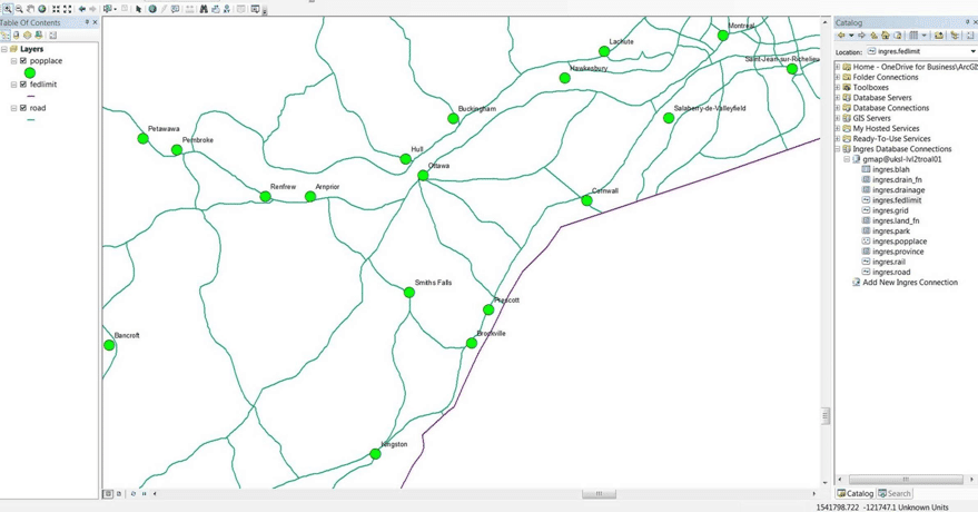
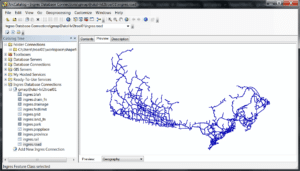
The ESRI plugin supports two of the tools, ArcMap and ArcCatalog, in versions 10.x of ArcGIS on Windows, and Actian supports the plugin on Ingres 10S, 10.2, and Actian X. ArcMap is the primary application used in ArcGIS for mapping, editing, analysis and data management. With the ESRI plugin and ArcMap, users can access geospatial data in Actian X to create maps, visualize, filter, summarize, analyze, compare and interpret spatial data. ArcCatalog allows users to store and organize Actian X geospatial data (like a Windows Explorer for geospatial data).
Actian is working with a couple of partners to help our customers get the most out of Ingres and ArcGIS.
- Critigen provides implementation services with ESRI expertise to develop and deploy geospatial applications.
- Safe Software supports Ingres through their FME integration tool and complements Actian DataConnect.
The ESRI plugin and documentation are available to existing Actian customers for download at esd.actian.com. To find out more about Actian X geospatial features, go to docs.actian.com.
Download the ESRI plugin and let us know what you think!
Subscribe to the Actian Blog
Subscribe to Actian’s blog to get data insights delivered right to you.
- Stay in the know – Get the latest in data analytics pushed directly to your inbox.
- Never miss a post – You’ll receive automatic email updates to let you know when new posts are live.
- It’s all up to you – Change your delivery preferences to suit your needs.
Subscribe
This email extension () is not allowed. Please update.
This personal email address domain () is not allowed. Please update.